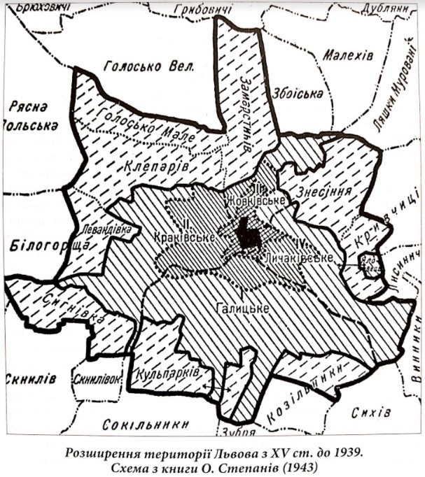
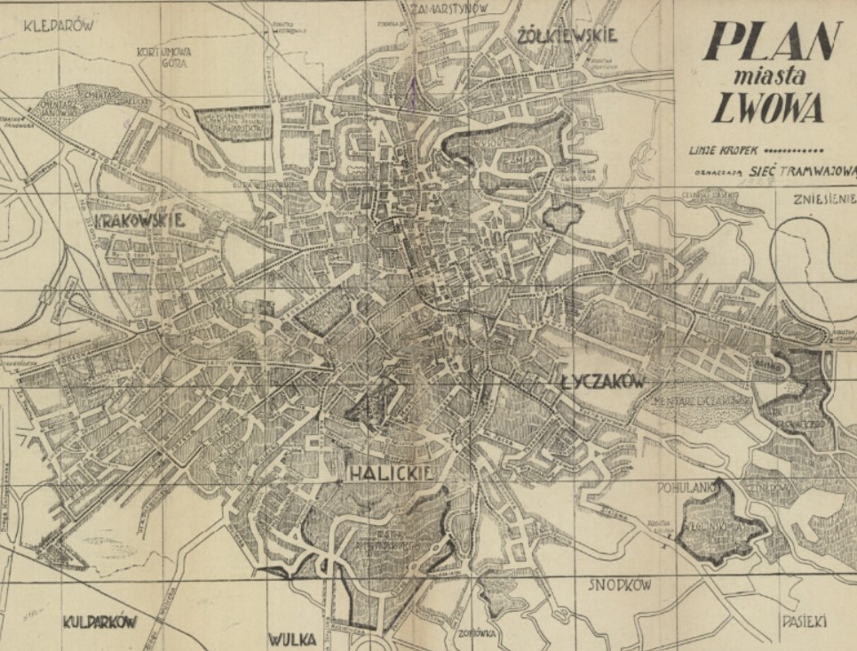
A look at Lviv’s territorial expansion and annexation of former manorial farms
Most people are familiar with how Lviv got its name — founder King Danylo of Halych named the city in honor of his son Lev (“lion”). But what about the names of Lviv’s neighborhoods?
It turns out a lot of them derive from French, Italian, Armenian, Polish, and, in particular, German surnames. This is explained by the fact that many of the city’s neighborhoods arose from former manorial farms (Pol: folwark; Ukr: filvarok), which were named after their owners. Over the centuries, these names were Polonized and then ultimately Ukrainianized to get to what we have today.
The names of the oldest estates, founded by German merchants, were appended with the German -hof, which means “court” or “manor.” Later, these names were Polonized and the Polish possessive suffix -ów was added; for example, Klöpperhof (Klöpper’s estate) eventually became Kleparów. In other cases, when foreign names were Polonized or when toponyms were created from local names, the suffix -ówka was added; for example, the name Zofiówka was created from the name Zofia. The Ukrainian versions of these names are similar to the Polish ones, but instead of -ów or -ówka, the suffixes -iv and -ivka, respectively, were added.
Only a few of the neighborhoods we know today were never estates and thus they got their names in other ways.
But why were so many foreigners establishing estates near Lviv? And how and when did these territories become part of the city? To understand this, we must look at the history of Lviv and of its territorial expansion.
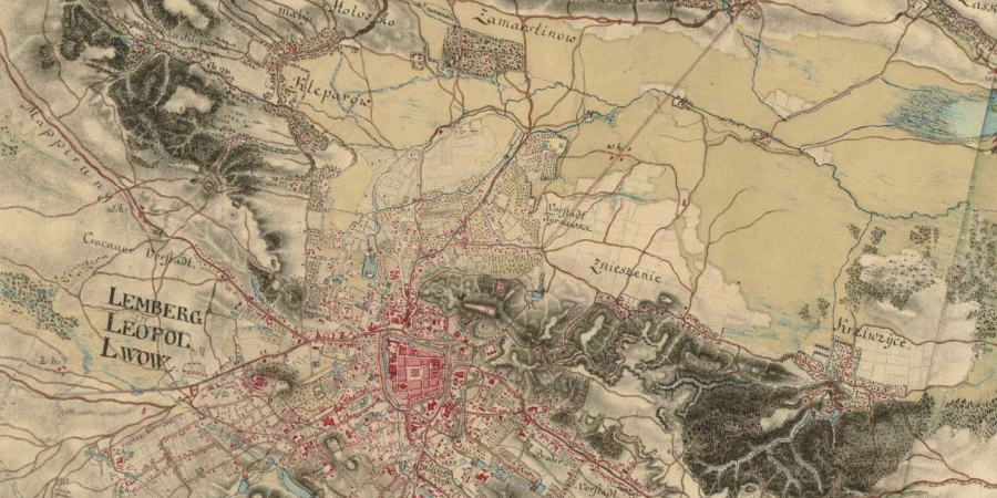
Source: Бірюльов, Архітектура Львова
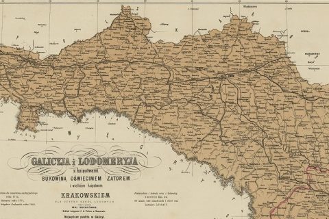
Territorial Expansion of Lviv
Early History
Lviv was founded in 1256 by King Danylo of Halych in the Ruthenian principality of Halych-Volhynia. At first the city covered a small area on the right bank of the Poltva River and consisted of three parts: a stronghold on Lysa Hill, the inner town at the foot of the stronghold, and the outer town. Besides Ukrainians, the town was inhabited by Germans, Armenians, Poles, Tatars, Karaites, Hungarians, and Jews.
In 1349, Casimir III the Great captured Lviv, and after a short period of joint Polish-Hungarian rule (1370–87), the city was annexed by Poland. In 1356 Casimir granted the town Magdeburg rights, which enabled the German and Polish merchants to take control of the municipal government. This brought on an influx of German merchants and tradesmen.
In the second half of the fourteenth century, the town center shifted southwest to the wide valley of the Poltva River. Walls were built around Lviv, and in the fifteenth century they were expanded and reinforced.
In 1368 Lviv expanded beyond the walled city after acquiring territory encompassing one hundred łans (~2300 hectares of land). On these lands, several wealthy and powerful Lviv burghers founded manorial estates, which eventually turned into suburban villages subordinated to their owners, the Lviv patricians.
In 1415, King Władysław Jagiełło added more territories to the city, the so-called obshary — the land that lay behind the 100 łans to the defined boundaries of the existing villages. Revenues from the estates on these lands were used to maintain the city’s fortifications.
Austrian Lviv
A new stage in the territorial development of Lviv began with the city’s transition to the rule of the Austrian monarchy in 1772. Within a few years, the Austrians began dismantling the fortifications around the city center, planning avenues on the site of ramparts and ditches, and constructing the other bank of the Poltva River, west of the Old Town. Thus began the process of joining the suburban territories to the city.
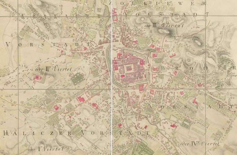
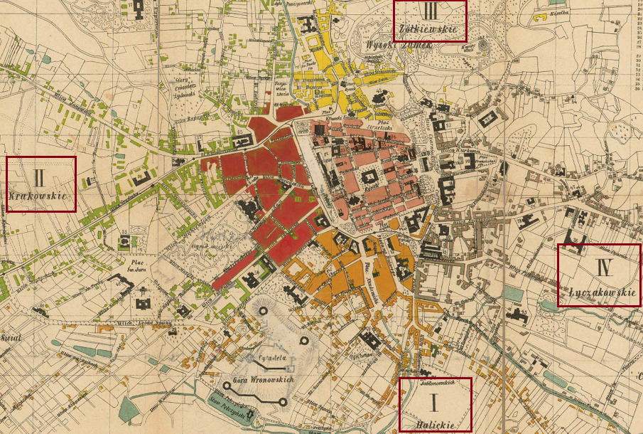
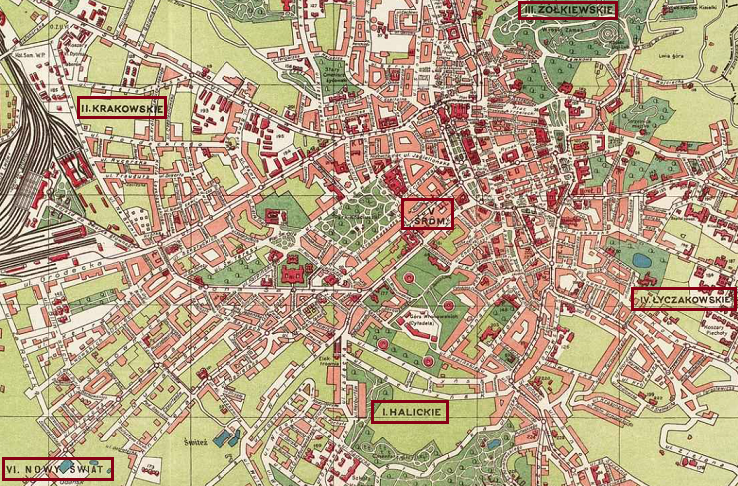
In 1789, the administrative border of the city was decided on, which in addition to the former walled city, included the suburbs (in German “Vorstadt”; in Polish “przedmieście”), from which four districts (in Germany “Viertel“; in Polish “część,” “dzielnica“) subordinated to the Lviv municipality were created:
- I. Halych (Haliczer / Halickie) – south of the center
- II. Krakiv (Krakauer / Krakowskie) – west of center
- III. Zhovkva (Zolkiewer / Źółkiewskie) – north of the center
- IV. Brody (Broder), later Lychakiv (Lyczakower / Łyczakowskie) – east of the center
The next stage of the city’s expansion was in the second half of the nineteenth century. This was facilitated by the rapid economic development of Galicia and of Lviv in particular. At this time, several large industrial enterprises were built in Lviv, and after the construction of the Lviv-Przemyśl railway in Galicia in 1861, the city also developed as a major transport hub. All this contributed to the increase in the number of inhabitants in the outlying districts.
By the end of the nineteenth century, the lands that were annexed to Lviv at the end of the previous century were fully integrated into city life.
Interwar Lviv under Poland
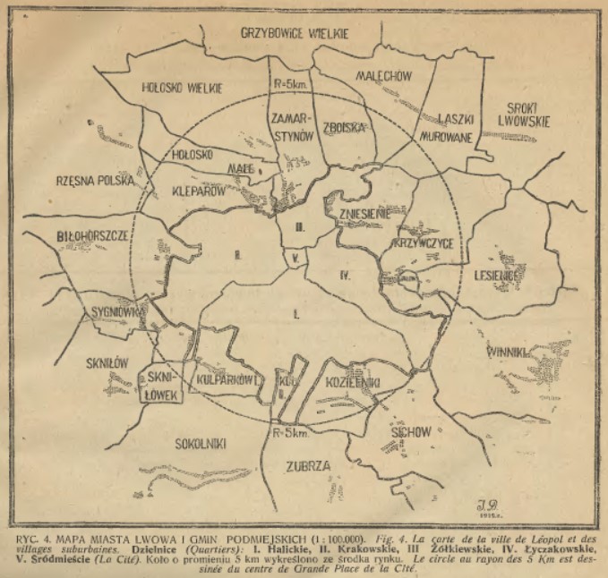
After WWI, Lviv become part of the Second Polish Commonwealth. Within a few years, in the early 1920s, Ignatius Drexler introduced a development project for the city called “Wielki Lwów” (Greater Lviv) — the aim of which was to expand the borders of Lviv through the annexation of suburban villages. The project would also foresee the modernization of the urban infrastructure and communication systems as well as the implementation of administration reform and self-government. According to the concept, Greater Lviv would include all villages within a radius of 30 km.
This project was implemented at the beginning of the next decade, once again expanding the borders of Lviv. As a result, on April 11, 1930, it was agreed to incorporate the suburban territories of Kleparów (Klepariv), Zamarstynów (Zamarstyniv), Małe Hołosko (Male Holosko), Zniesienie (Znesinnia), Kulparków (Kulparkiv), Krzywczyce (Krychytsi) (partially), Kozielniki (Kozelnyky), Sygnówka (Syhnivka), Białohorszcza (Lewandówka (Levandivka), partially), and Persenkówka (Persenkivka) into the city. By April 1, 1931, these villages were officially part of Lviv.
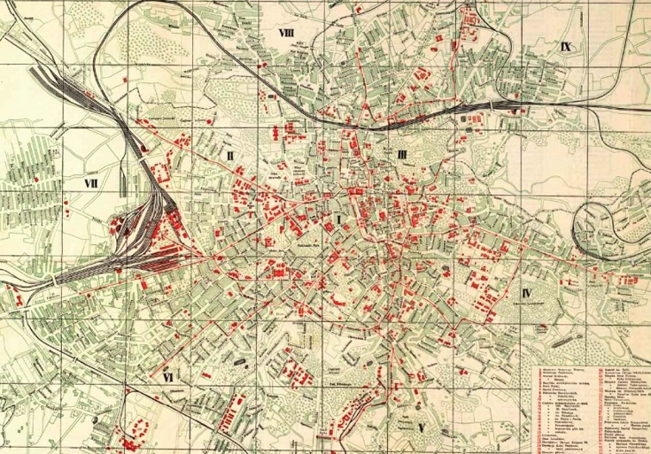
The expanding city also meant that districts were redrawn and new ones were added. By the eve of WWII, Lviv was divided into nine districts.
Neighborhoods
In summary, many of today’s neighborhoods became part of Lviv during the Austrian era as the city’s territory expanded and the suburban areas — partly made up of former estates-turned-villages — were integrated into the city’s administrative districts. Finally, in the 1930s, several outlying villages were annexed by Lviv.
It’s important to note that in some cases, the boundaries of neighborhoods have changed over the years. For example, today, Klepariv is considered the area along Kleparivska Street; however, originally, Klepariv was located farther north.
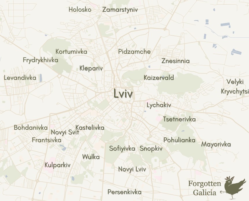
Now let’s look at the individual stories behind the names of Lviv’s neighborhoods. The list below is not complete — I left out a couple micro-neighborhoods as well as a few of the peripheral neighborhoods that became part of Lviv in the 1930s (e.g., Holosko, Kryvchytsi, Zboiska).
- Bohdanivka / Bogdanówka
- Franstivka / Franzówka
- Frydrykhivka / Frydrychówka
- Kaizervald / Kaiserwald
- Kastelivka / Kastelówka
- Klepariv / Kleparów
- Kortumivka / Kortumówka
- Kulparkiv / Kulparków
- Levandivka / Lewandówka
- Lychakiv / Łyczaków
- Mayorivka / Majerówka
- Novyi Lviv / Nowy Lwów
- Novyi Svit / Nowy Świat
- Persenkivka / Persenkówka
- Pidzamche / Podzamcze
- Pohulianka / Pohulanka
- Snopkiv / Snopków
- Sofiyivka / Zofiówka
- Tsetnerivka / Cetnerówka
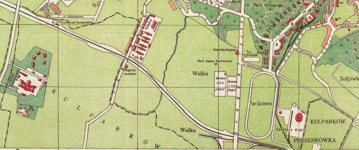
- Vulka / Wulka
- Zamarstyniv / Zamarstynów
- Znesinnia / Zniesienie
Bohdanivka / Bogdanówka
Founded: 17th century as a suburban estate
Named after: Armenian Bogdanowicz family
This territory was once the the suburban estate of the Armenian Bogdanowicz family. On June 29, 1645, Anastasia Avedykovych bequeathed the Bogdanówka estate to the pharmacists of the Armenian Church in Lviv.
The name Bogdanówka was given initially to the Bogdanowicz estate, then to the suburb and its main street, and then to the city neighborhood.

1890 
1918 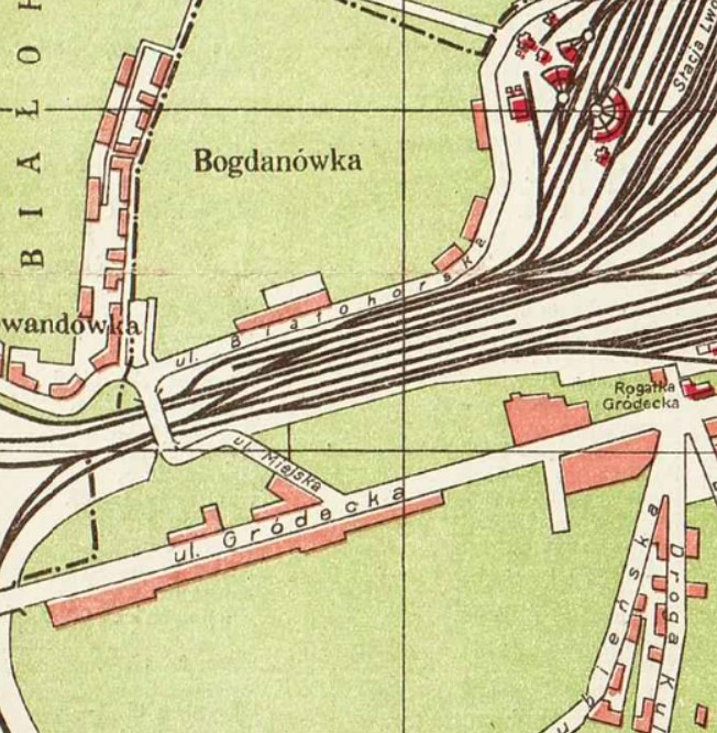
1922 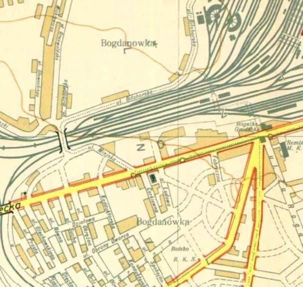
1931
Franstivka / Franzówka
Founded: 1890s as a developed area
Named after: Entrepreneur Anthony Franz
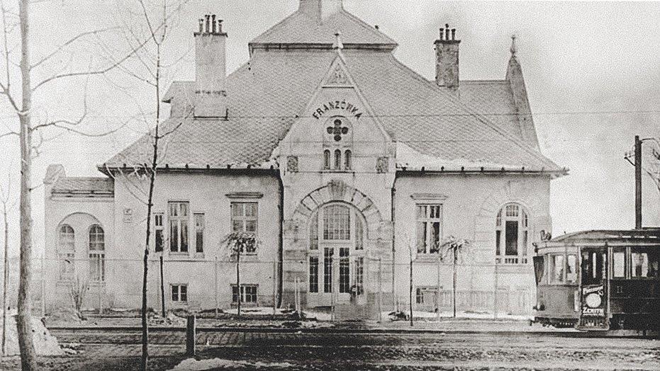
This neighborhood was named after the Franz family who owned a plaster factory, which was established in 1856. After the death of the founder Jozef Franz in 1871, his widow Józefa and sons Antoni and Jan inherited the company.
The Franz factory operated in the west side of the Bajki neighborhood, between today’s Konovaltsia and Hordynskykh Streets. In the 1890s, after former gypsum quarries and gardens were parcelled, Anthoni Franz began actively developing this area, especially on Konovaltsia Street. Subsequently, this neighborhood took on the name Franzówka.
In 1892, a villa was built for Józefa Franz on Konovaltsia. Today it is one of the most exquisite buildings in Lviv.
The street parallel to Konovaltsia still bears the name Hipsova (Gypsum Street), as it used to lead to the Franz’s factory. Other traces of the former factory activity are two small lakes, called Altayski or Piskovi, which were formed in the depressions of the excavated gypsum.
Frantsivka today has many fine examples of Historicist, Secession, Art Deco, and Functionalist architecture.

1939
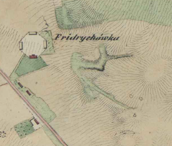
Frydrykhivka / Frydrychówka
Founded: Late 18th century as an estate
Named after: Friderike von Kortum
This neighborhood gets its name from the tomb of Friderike von Kortum, the wife of advisor to the governor of Galicia Ernst von Kortum. Friderike was buried in von Kortum’s private park, located on his estate Kortumówka. Later this area became known as Frydrychówka.
At the end of the nineteenth century a large factory of building ceramics was built on the territory of Frydrychówka, founded by Ivan Levynsky & Aleksander Domaszewicz.
1844 
1878 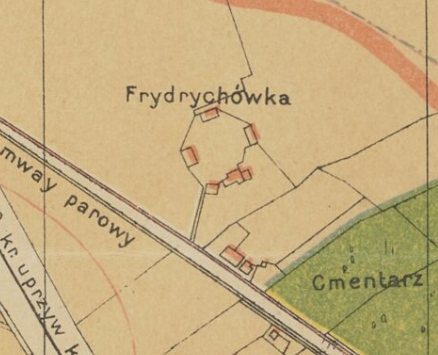
1890 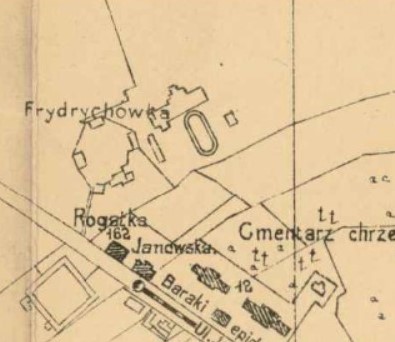
1910 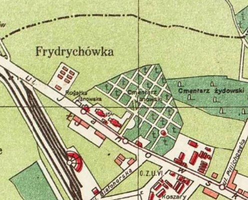
1922 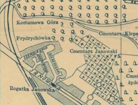
1938
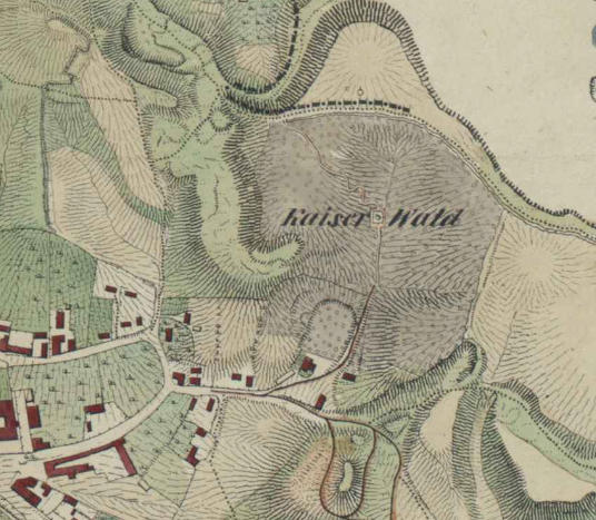
Kaizervald / Kaiserwald
Founded: End of 18th century as an estate
Original name: Lonshanivka / Lonszanówka
Named after: François Longchamps de Bérier
Second name: Kaiserwald or Cesarski lasek after Emperor Joseph II
This area was once named Lonszanówka (Lonshanivka), which was derived from the name of local estate owner François Longchamps de Bérier. Longchamp, originally from France, served as Lviv mayor in 1766, 1774, 1777, and 1780. At the end of the eighteenth century, he bought this territory from the Alembek family, who owned a forest and apiary.
Legend has it that in 1780 this area was visited by Emperor Joseph II who enthusiastically commented on its beauty. Since then, Lonszanówka has also been called Kaiserwald (imperial forest), or in Polish Cesarski lasek. Due to the beauty of the surrounding groves, from the end of the eighteenth century the terrains of the future park have been a popular place for recreational walks.
From 1908 to 1914, the first amusement park in Ukraine with many attractions and summer restaurants operated in Kaiserwald.
Today Kaizervald is the Znesinnia landscape park.
1844 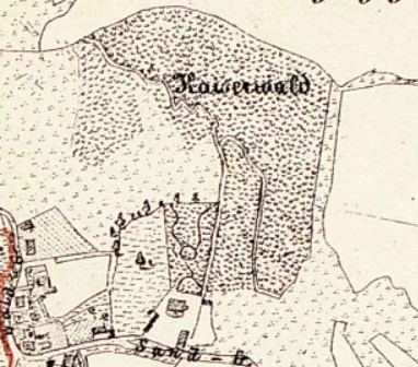
1873 
1900 
1922 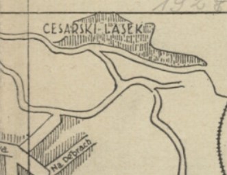
1927 
1931
Kastelivka / Kastelówka
Established: 1880s as a villa district
Named after: Castelli family
The name Kastelówka derives from Castelli, the name of an Italian family of builders who arrived in Lviv at the end of the sixteenth century to help reconstruct the city after numerous destructive fires. By the end of that century, the Castelli family owned an estate in the area of the modern Sakharova Street, which was marked on maps with the name “Kastelówka.”
In the late 1890s, architects Ivan Levynsky and Julian Zachariewicz chose this name for their villa district, even though the territory of their district was outside of the former Castelli estate. Today, the name Kastelivka refers only to the territory of the villa district.

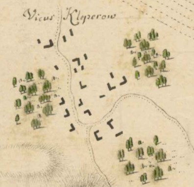
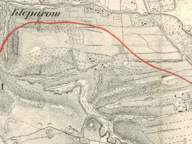
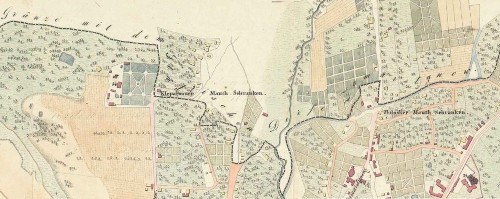
Klepariv / Kleparów
Founded: 1430 as an estate
Named after: Andreas Klöpper (Klöpperhof)
Annexed by Lviv: 1930
At the beginning of the fifteenth century, Andreas Klöpper, a burgher from a well-known Lviv family of builders who built the walls around Lviv, bought lands on the outskirts of Lviv and in 1419 established Klöpperhof (Klöpper estate) and in 1430 a village. The original name Klöpperhof was eventually transformed into the Polish to Kleparów.
Between 1535 and 1560 the village community became known for its good soil, ponds, and grapes, which brought it fame along with its bleached linens. In the middle of the century, residents cultivated and grew the widely exported Griotte de Kleparow (Sour Cherry of Kleparów).
Kleparów was annexed by Lviv in April 1930 and it stopped existing as a separate administrative unit.
While originally referring to the village outside of the city limits, later the neighborhood just south of the village along Kleparowska Street was also referred to as Kleparów. On a map from 1918 this area was already marked as such; however, most maps mark the territory farther north as Kleparów. Today, the Klepariv neighborhood is considered the area between the streets of Shevchenko, Dzherelna, and Yeroshenka, with the main street Kleparivska, which is farther south than the original Kleparów.
1770 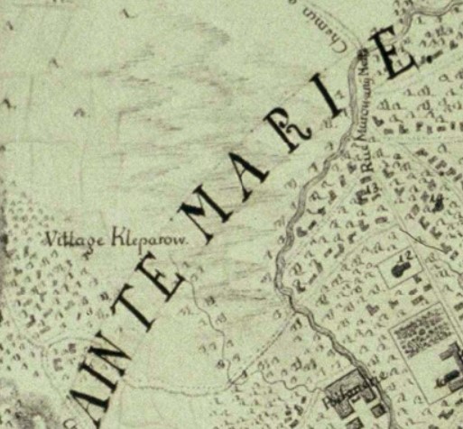
1770 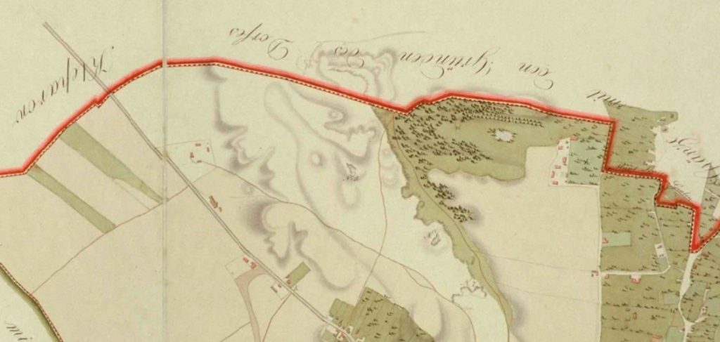
1828

1836 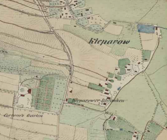
1844 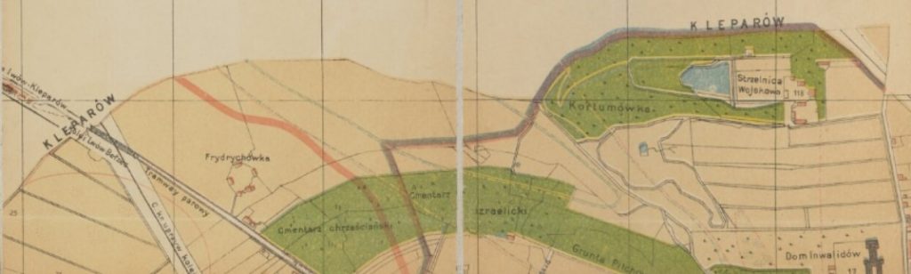
1890


1905 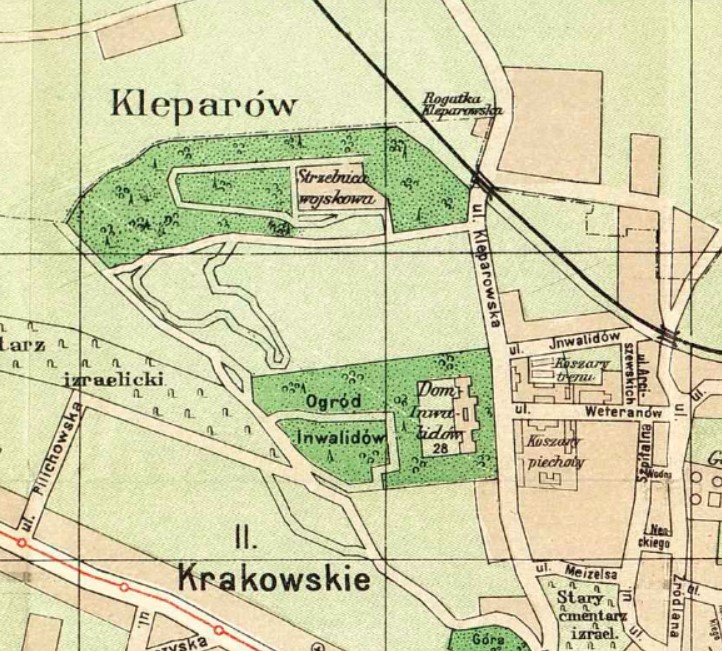
1911 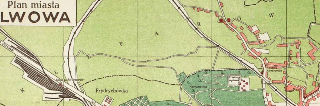
1922

1931 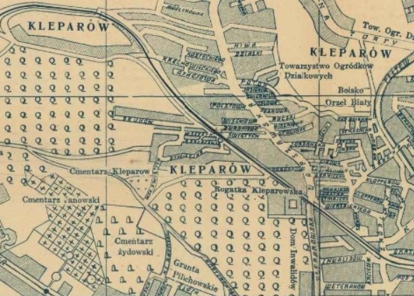
1938
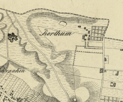
Kortumivka / Kortumówka
Founded: Late 18th century
Named after: Ernest von Kortum
The toponyms Kortumówka (Kortumivka) and Kortumowa Gora (Kortumova Hora) derive from the name Ernst von Kortum, advisor to the governor of Galicia (Gubernialrath) and author of the work Magna charta von Galizien (1790), who at the turn of the eighteenth and nineteenth centuries established an estate here.
In the middle of the nineteenth century, the Austrian military owned this territory and turned the estate into a shooting range.
Today, Kortumivka is a forest park.
1841 
1871 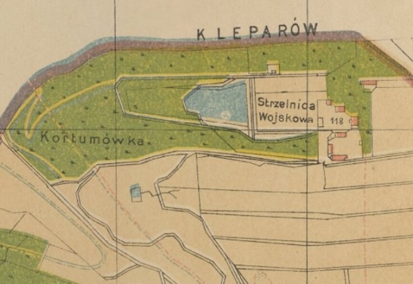
1890 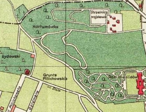
1922 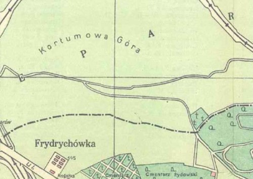
1925 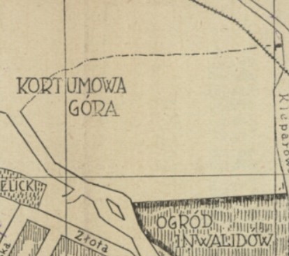
1927
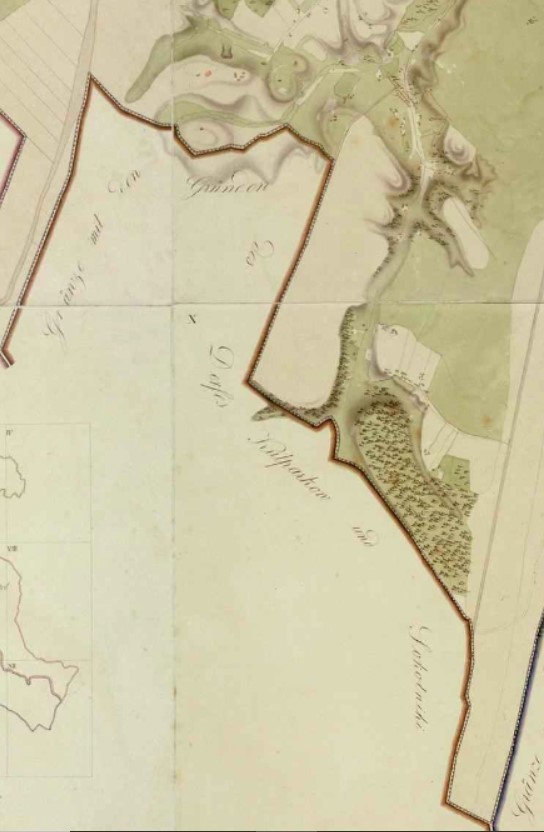
Kulparkiv / Kulparków
Founded: 1425 as an estate
Named after: Burgher Paul Goldberg’s estate (Goldberghof)
Annexed by Lviv: 1930
This area was located outside the lands donated to Lviv in 1356 by Polish King Casimir III. The settlement appeared on the site of uprooted forests and belonged to the burgher Paul Goldberg. On his behalf, the estate was named Goldberghof, and later Goldparków, which was eventually transformed into Kulparków (Ukrainian: Kulparkiv).
The territory was actively developed at the end of the nineteenth century. This is when the Kulparków psychiatric hospital was built. Thus Kulparków also has a figurative meaning as the name of the psychiatric hospital.
Kulparków was annexed by Lviv in 1930.
1828 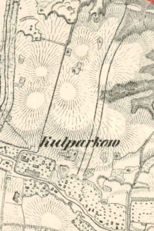
1836 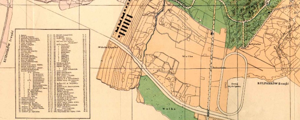
1900

1922

1932 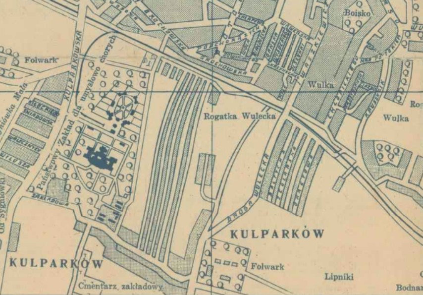
1938
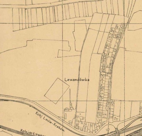
Levandivka / Lewandówka
Founded: End of 18th century
Named after: German colony Löwendorf or Lewandowski lords
Annexed by Lviv: 1930
The history of the neighborhood begins at the end of the eighteenth century. According to one version, the toponym comes from the surname of the Lewandowski lords. According to another version, the name comes from the German colony Löwendorf (“village of lions”), which existed here in the eighteenth century (the first mention of the colony dates back to 1778).
In the nineteenth century, in the eastern part of the village, called Blonie Janowskie, was a field used by the Austrian army for drilling. It was here in 1843 that the first horse races in Lviv took place.
At the beginning of the twentieth century, the Lviv airfield was located in Lewandówka, but it closed in the 1920s.
In April 1930 Lewandówka was annexed by Lviv.
1910 
1918 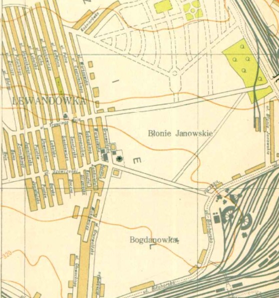
1931 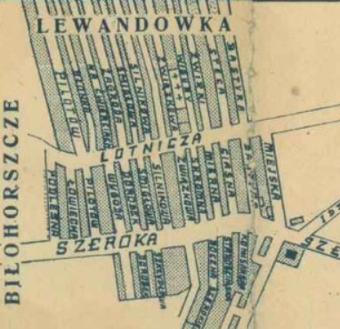
1938
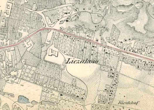
Lychakiv / Łyczaków
Founded: 16th century
Named after: Lütz family estate (Lützenhof)
In the sixteenth century, the German Lütz family established an estate (Lützenhof / folwark Lutzów) to the east of the Old Town, and subsequently a village was founded around it. Some believe that “Łyczaków” is derived from “Lützenhof.”
Others believe that “lychaky” — shoes made from woven bast (the bark of a tree) — was the basis for the name as at that time, the local peasants wore such shoes.
The inhabitants of these area were engaged in gardening, milling (grinding grain into cereals and flour) and baking (hence the street names Pekarska (baker), Muchna (flour), Krupyarska (cereals), men were carters, and Łyczaków women were hired to Lviv houses to ferment cabbage, clean carpets, and more.
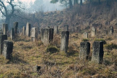
At the end of the eighteenth century, the Lychakiv Cemetery was established on the outskirts of the suburb. By the end of the nineteenth century, the suburb had been fully incorporated into the city.
1836 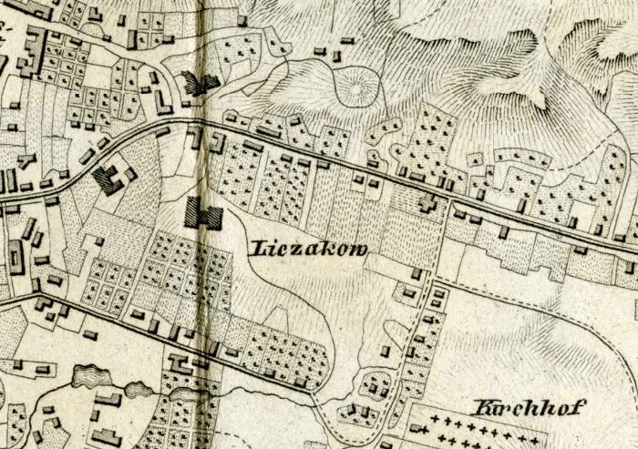
1841 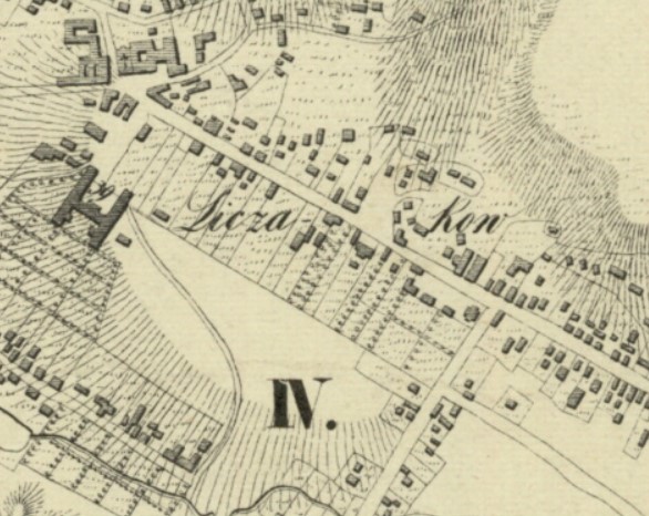
1841 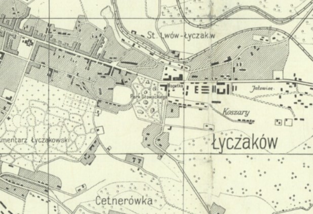
1918 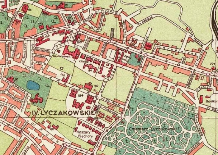
1922 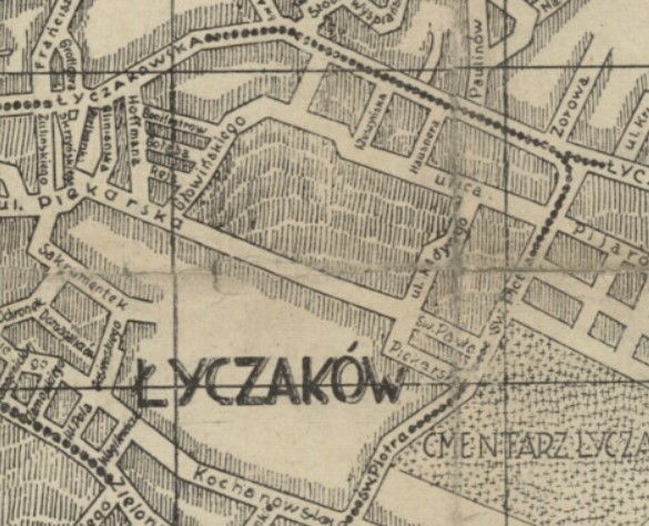
1927
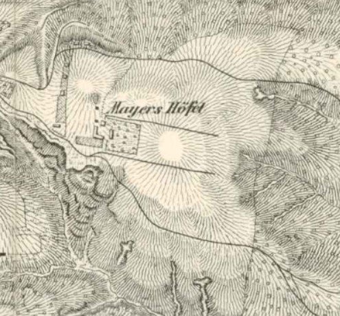
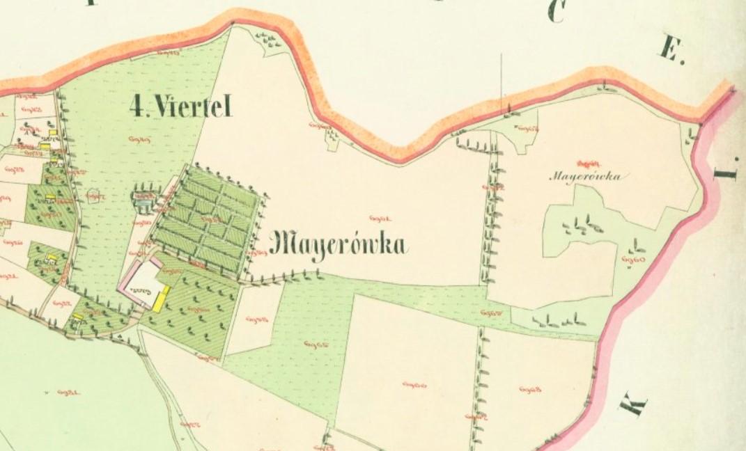
Mayorivka / Majerówka
Founded: Mid-19th century
Named after: Josef Mayer’s estate (Mayers Höfel)
In the middle of the nineteenth century, botanist Josef Mayer established his estate here; hence the area was called Mayers Höfel (Mayer’s estate) and later the Polonized Majerówka.
In the 1870s and 1880s, the Austrian army built forts here. The remains of pentagonal earthen fortifications in the area have been preserved in the forest. In the 1930s, Andrey Sheptytsky bought Majerówka and created a holiday home for students of the Lviv Greek Catholic Seminary and Theological Academy. In 1909–1944, the Lviv-Pidhaytsi railway passed through here.
1836 
1849 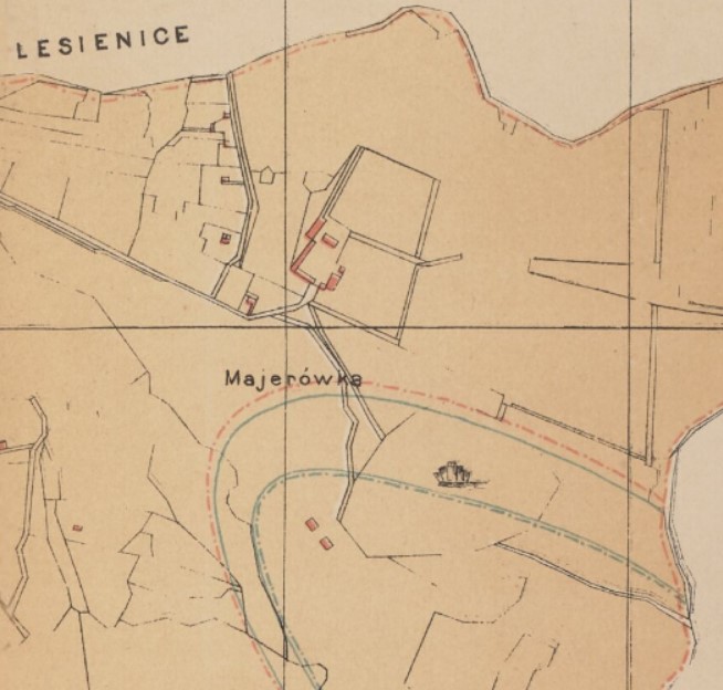
1890 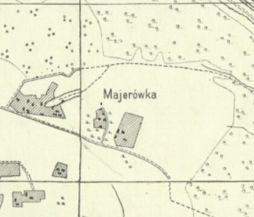
1918
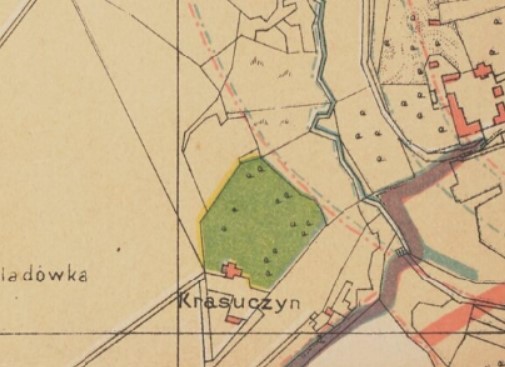
Novyi Lviv / Nowy Lwów
Founded: 1881
First name: Krasuczyn after Mikołaj Krasucki’s estate
Current name: Appeared as the name of a planned neighborhood in the early 20th century, means “New Lviv”
At the end of the nineteenth century, Mikołaj Krasucki founded an estate on this territory, which was called Krasuczyn (earlier it was called Kraterówka).
In 1910 Ferdinand Kassler and Aleksander Osten planned to build a “garden city” here. The district was designed in the form of a rectangle with a large round square-sun in the center, from which diverged six streets-rays. It was planned to build villas and two- and three-story houses surrounded by gardens. By the beginning of World War I, only a few houses had been built.
In the 1930s, part of these neighborhood was developed under the supervision of Tadeusz Wróbel with Functionalist villas. In 1933, a water tower was built, designed by Witold Minkiewicz, to supply water to the area. In the interwar period, it started to be called “Nowy Lwów,” as a it was a newly developed part of Lviv.
1890 
1909 
1910 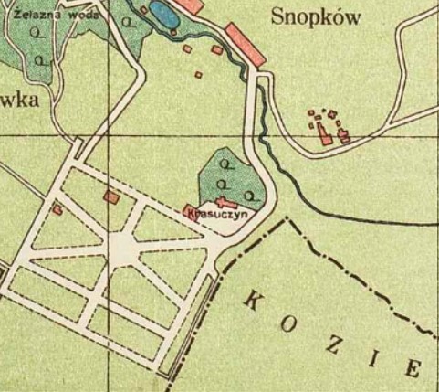
1922 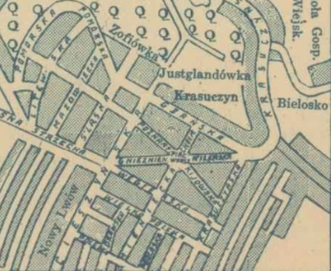
1938 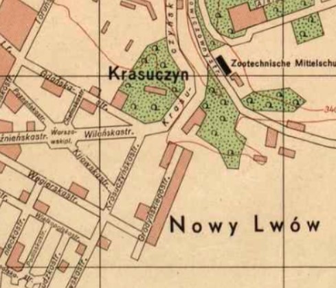
1944
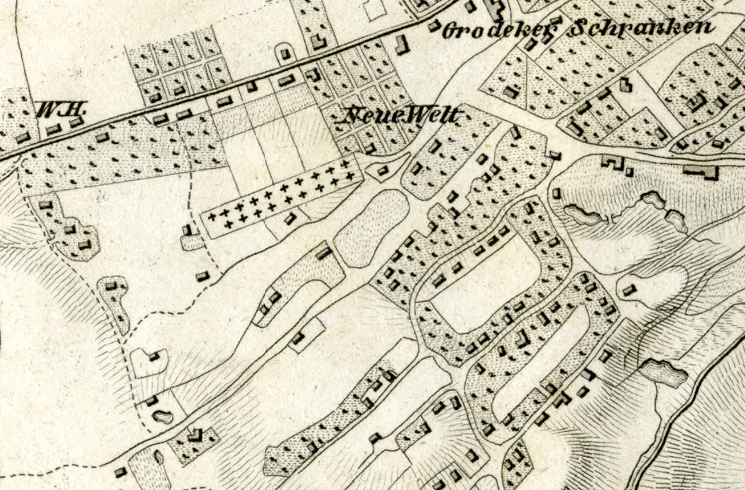
Novyi Svit / Nowy Świat
Originally: Suburban village
First name: Bajki
Current name: Appeared as the name of a city district by mid 19th century
Originally a suburban village of Lviv, by the sixteenth century Bajki is mentioned as a Lviv suburb. By the mid nineteenth century, Neue Welt / Nowy Świat (New World), which included the territory of Bajki, was a city district. Its inhabitants were engaged in gardening and horticulture (hence the former name of Antonovycha Street was Sadownicka) as well as masonry (hence the former name of Yefremova Street was Murarska).
In 1870, the Lviv magistrate arranged the names of the streets and introduced the numbering of houses and plots. At the end of the nineteenth and early twentieth centuries Nowy Świat was an elite neighborhood.
Today, Novyi Svit is still an elite district with beautiful homes.
1841 
1844 
1878 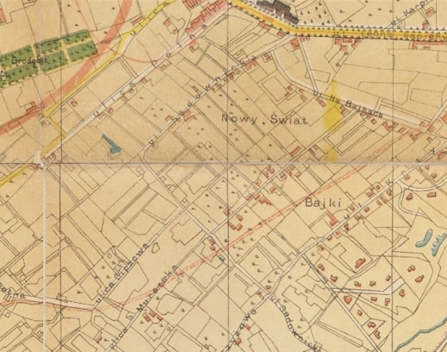
1890 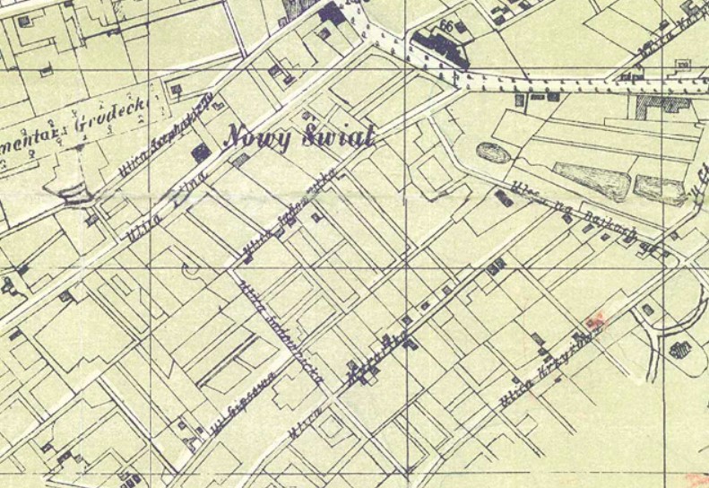
1892 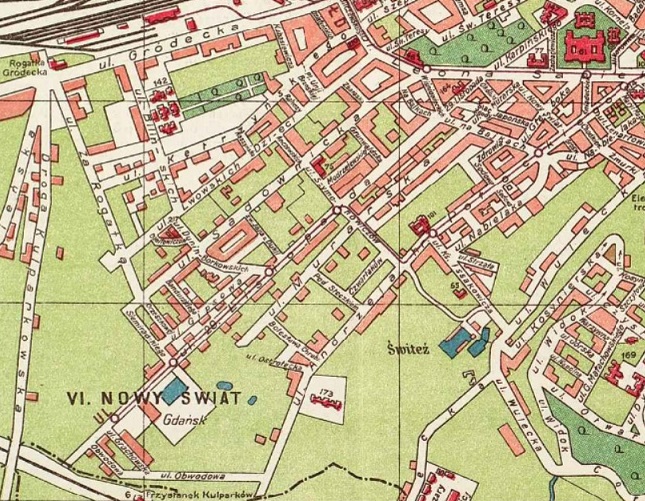
1922
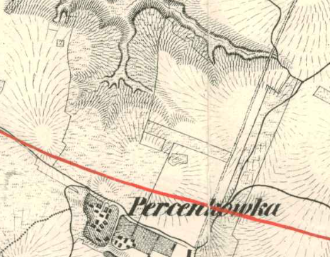
Persenkivka / Persenkówka
Originally: Kosner’s estate named Kosnerówka
Present name from: Jakub Persing
Annexed by Lviv: 1930
Until the seventeenth century, the area was named Kosnerówka after the owner of the local fields, a burgher Kosner. In 1687, Jakub Persing bought this plot, and its new name was Persenkówka.
The most important enterprise of Persenkówka was the second and main Lviv municipal power plant, built by Alfred and Kazimir Kamenobrodsky in 1908 according to the design of architect Adolf Piller.
1836 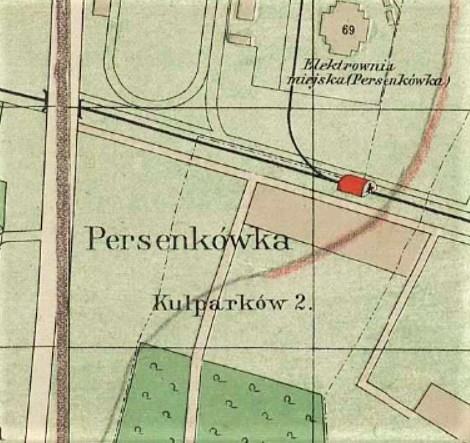
1910 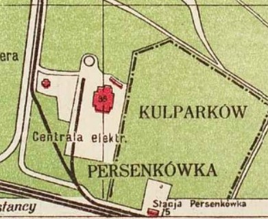
1922 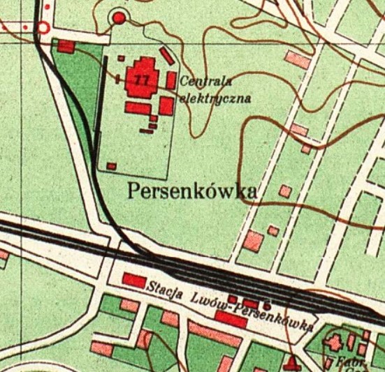
1931
Pidzamche / Podzamcze
Founded: 1694 as an estate
First name: Gabrjelówka from Gabrielli family estate
Current name: Appeared from the name of the local railway station at by end of 19th century
At first, this area was named Gabrjelówka after the Gabrielli family, rich burghers who had an estate here in the seventeenth century. However, with the construction of the railway and of the Podzamcze / Pidzamche (meaning “under the castle”) station, the district began to be called in unison with the name of the station. This is the name that exists today.
In the late nineteenth and early twentieth centuries, this was a working class neighborhood as many factories were located here.
Today, many of the former factories are being converted into art and cultural centers, and life is being brought back to the neighborhood.
1890 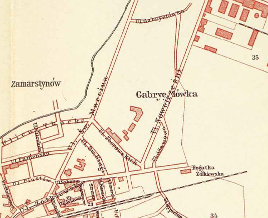
1907 
1922 
1932
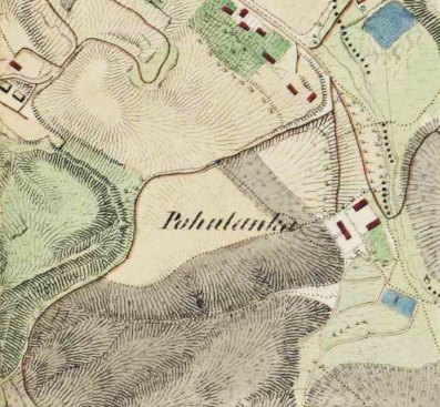
Pohulianka / Pohulanka
Originally: An estate and later promenade park
Named after: From the word “huliaty” which means “to walk”
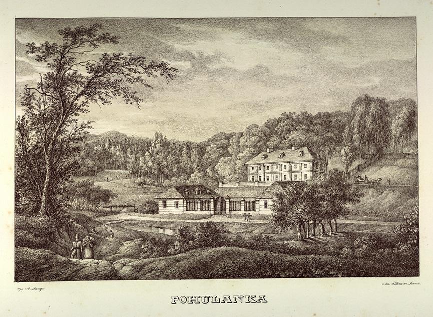
Named after the promenade park in the area, “Pohulanka” (Pohulianka) derives from the word “huliaty,” which means “to walk.”
In the seventeenth century, Pohulanka, which lay just outside the city limits, was part of the so-called Attelmayer Apiary. The Dame family was the first to build their estate here. In 1810, a part of the fields was bought by prominent Lviv lawyer Franciszek Węgliński, who also built an estate here. Thanks to Węgliński, this place became a promenade park, and the area adjacent to the estate was named in his honor “Węgliński Forest.”
In 1821, Pohulianka was bought by restaurateur Johann Diestl, and in the middle of the nineteenth century, Johann Klein founded a brewery here. The area was designated as a forested public park in 1940.
1844 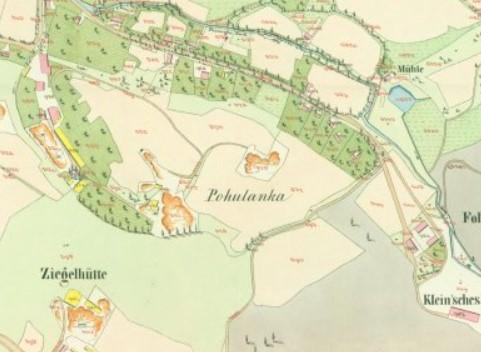
1849 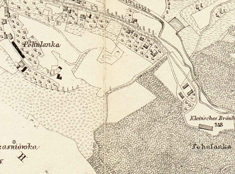
1878 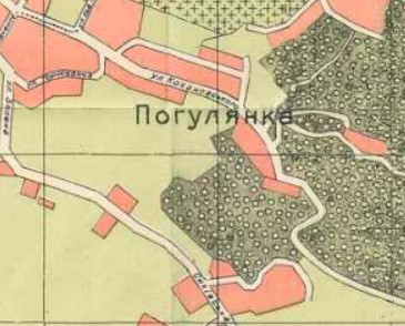
1905 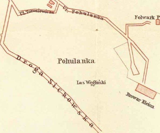
1907 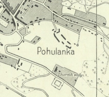
1918 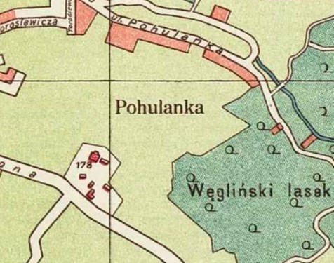
1922 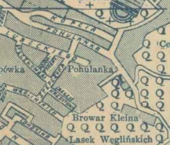
1938
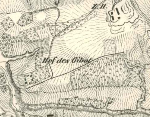
Snopkiv / Snopków
Alternate name: Gibówka from Pièrre Denis Guibaut’s estate
Current name: Appeared from the Snopków estate
The name originates from the former Snopków estate that used to be on this territory.
Around 1790 Lviv architect of French origin Pièrre Denis Guibaut built a palace for himself on the Snopków estate. Hence, this area was also called Hof des Gibot (Gibot’s estate) or Gibówka.
In 1871, Snopkivska Street was named after the area.
1836 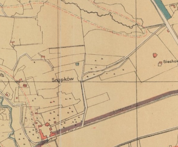
1890 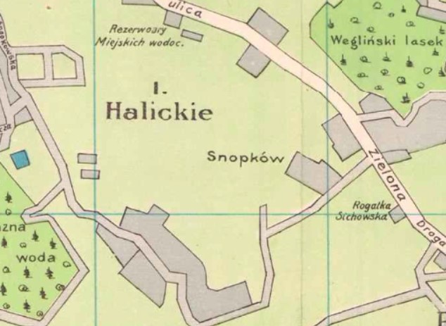
1909 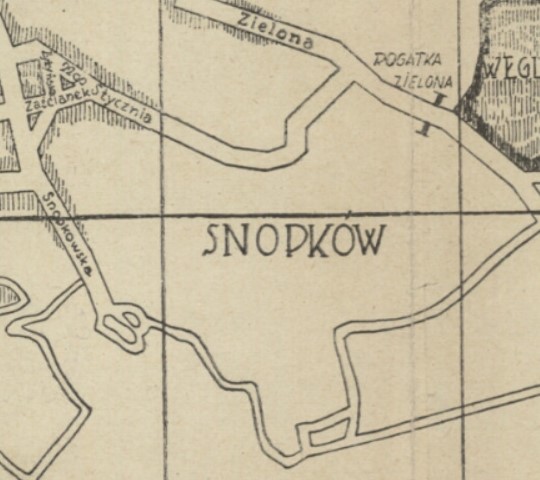
1927
Sofiyivka / Zofiówka
Founded: No later than 16th century as an estate
First name: Kosznarówka, after Jan Kosznar’s estate
Current name: Appeared from the name of the local Church of St. Zofia
At first this area was known as Kosznarówka, which derived from the surname of Jan Kosznar, the former owner of a local estate and brickyard. In 1594, a small wooden church of St. Zofia (Sophia) was built at the expense of the burgher Zofia Hanel, the widow of Stanisław Hanel, the grandson of Jan Kosznar. At that time the area was not inhabited, so it was from the church that its name came — Zofiówka. Construction was revived somewhat after 1839.

1841 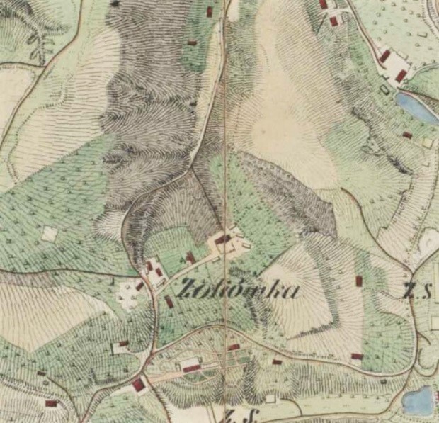
1844 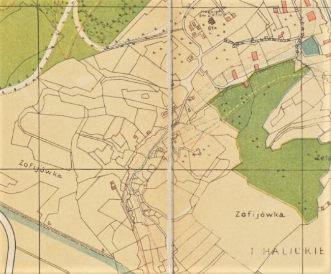
1890 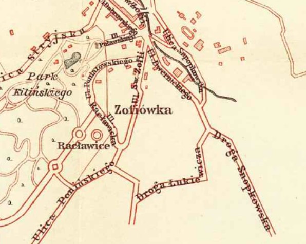
1907 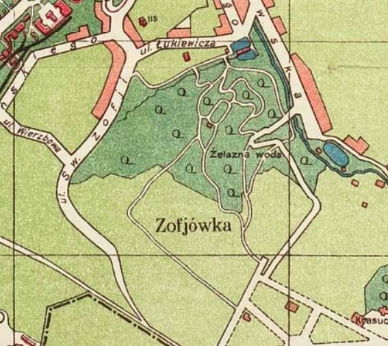
1922 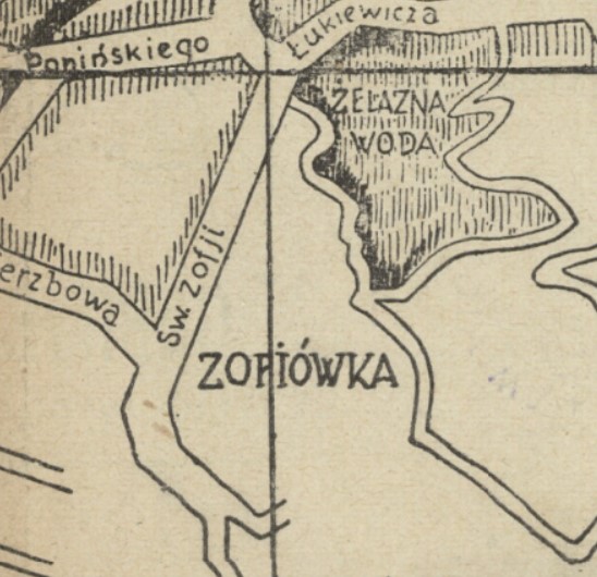
1927
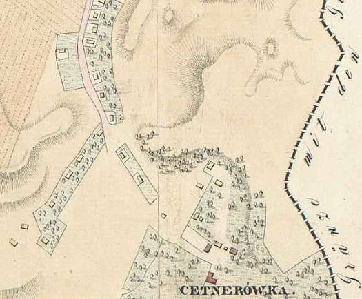
Tsetnerivka / Cetnerówka
Founded: Late 18th century as an estate
Named after: Ignacy Aleksander Cetner
The toponym derives from the name of the estate owner — Belz voivode Ignacy Aleksander Cetner, who in 1787 exchanged his title for the Austrian title of count and rose to the post of marshal of the Kingdom of Galicia and Lodomeria.
In the late eighteenth century, Cetner created a park here with exotic plants. He was assisted in this by the French architect Pièrre Denis Guibaut. Centner’s descendants maintained the park in good condition for some time, but later the territory was neglected
In the early twentieth century, part of Cetnerówka was bought by the government for the botanical garden of Lviv University. From 1871 to 1936, the street behind the Lychakiv Cemetery which led to the botanical garden was called Cetnerówska. Today it is Cheremshyny Street.
Today, Tsetnerivka is the name of a different street nearby, which was built with villas in the 1910s and 1920s.
1829 
1849 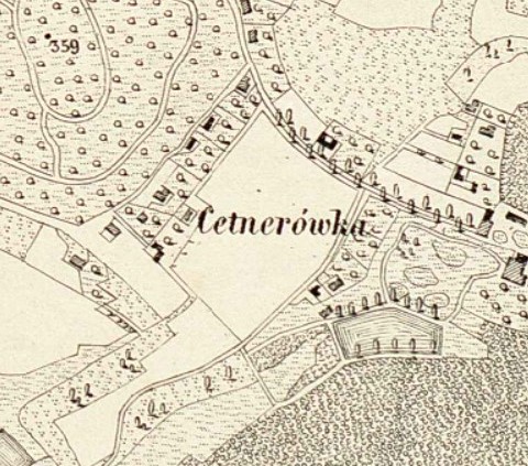
1878 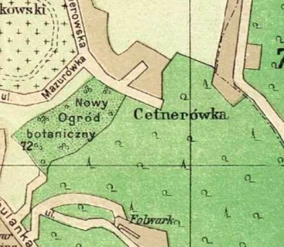
1911 
1918 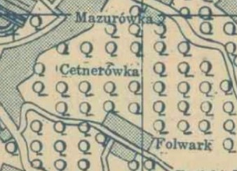
1938
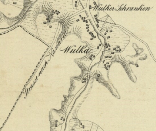
Vulka / Wulka
Founded: 17th century as a separate free suburban settlement
Named after: Polish word “wola” (“will”) – Wólka
The name “Wulka” comes from the diminutive of the Polish word “wola” (“will”) – Wólka.
Wulka was founded in the seventeenth century as a separate (free) suburban settlement above the Wulecki stream.
In the sixteenth and seventeenth centuries, this territory belonged to the Mykulchyn and Pelchyn districts of the Halych suburb, along which the road to the village of Sokilnyky ran.
In part of the neighborhood, manor buildings and planning of the nineteenth and early twentieth centuries have been preserved.
1841 
1890-95 
1905 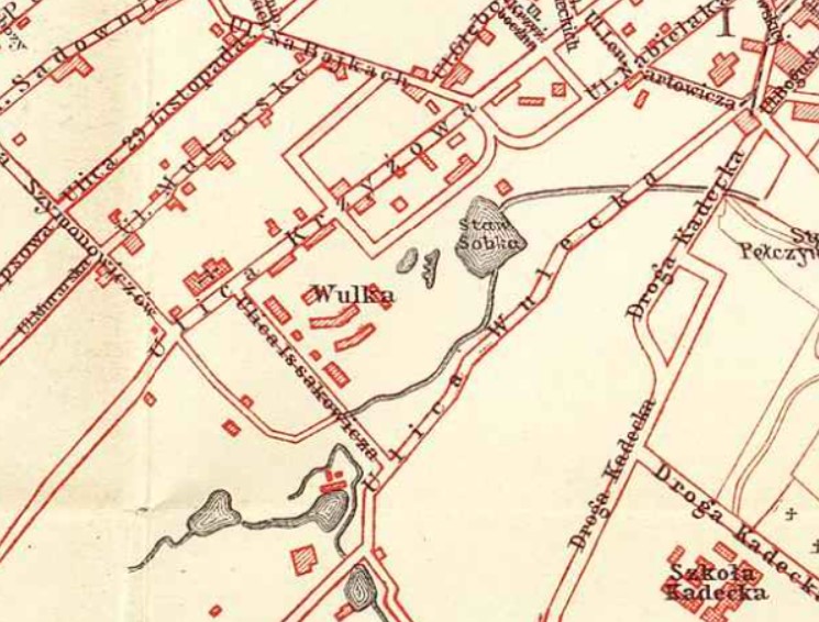
1907 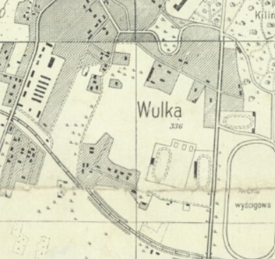
1918 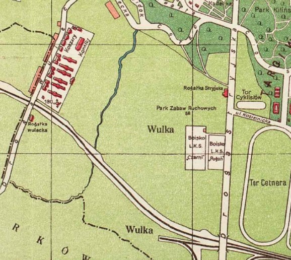
1922
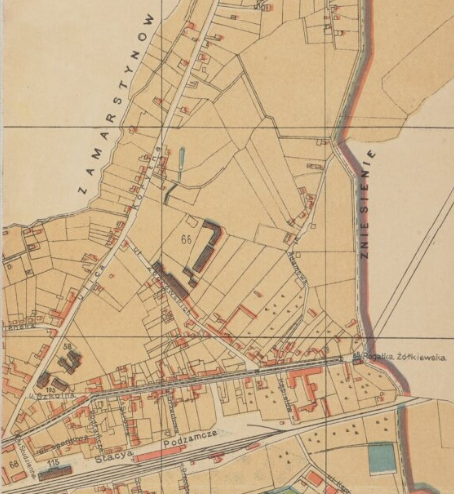
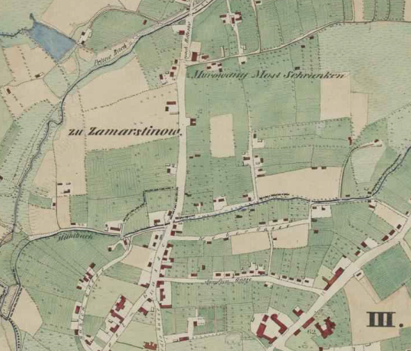
Zamarstyniv / Zamarstynów
Founded: 1386 as an estate
Named after: Andreas Sommerstein (Sommersteinhof)
Annexed by Lviv: 1930
At the end of the fourteenth century, these lands were acquired by the burgher Andreas Sommerstein. He later built the Sommersteinhof estate here. The name “Sommersteinhof” eventually became “Zamarstynów.”
In 1615 the city bought Zamarstynów from private property. Its inhabitants traditionally grew and sold vegetables and fruits at Lviv markets, and worked on numerous peatlands.
Until the sixteenth century, the village belonged to Lviv as one of its suburbs. It was not until 1615 that the city finally repaid its debts and Zamarstynów once again became municipal property. Surrounded by rich turf deposits, Zamarstynów also provided the nearby city with wood, fruits and vegetables. However, it was pawned to one of the burghers (Zebald Worcel), who in turn sold it in 1567 to Mikołaj Sieniawski, a notable member of the Polish-Lithuanian gentry,
Following the Partitions of Poland, no longer able to provide the town with goods, the village was sold into private hands in the early nineteenth century. Since then the settlement grew to become a residential suburb, finally being incorporated into the city in 1930.
1829

1844 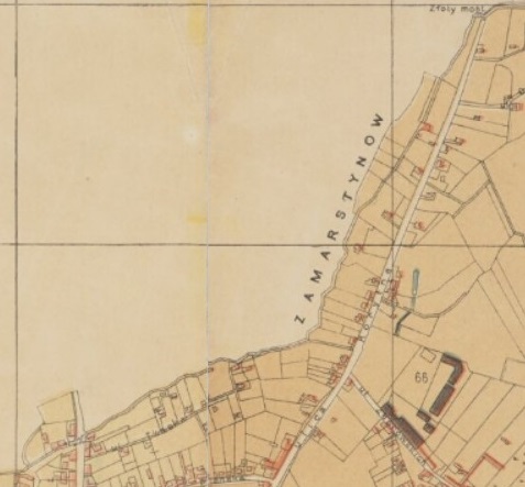
1890 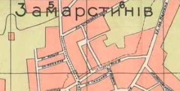
1905 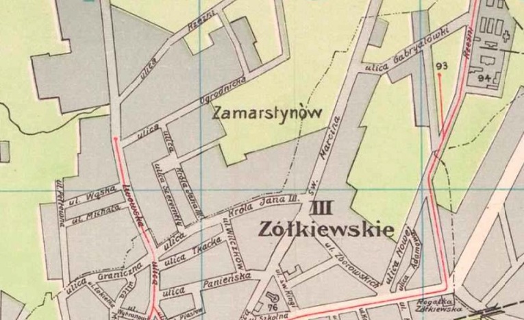
1909 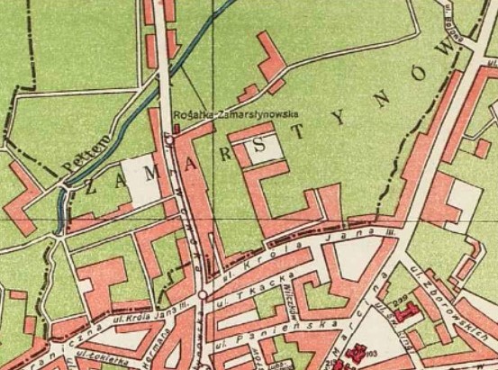
1922 
1939
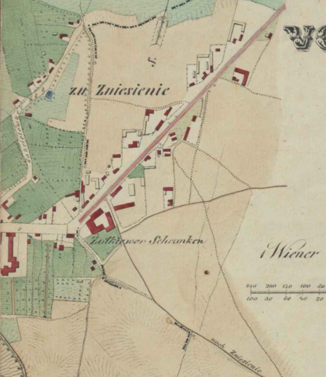
Znesinnia / Zniesienie
Founded: By 1598
Originally: Village
Named after: Voznesenska Church
Annexed by Lviv: 1930
The name of the district refers to the Voznesenska / Wozniesieńska Church (Eng: Ascension), which existed here from the sixteenth century.
In 1869 a railway line was built through the village, dividing it into New Zniesienie (in the north) and Old Zniesienie (in the south).
1844 
1890 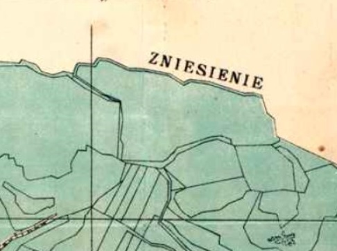
1900 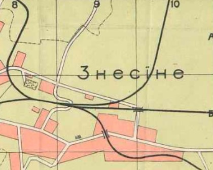
1905 
1918 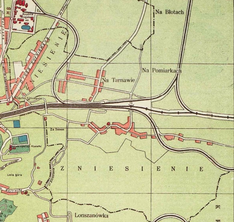
1922 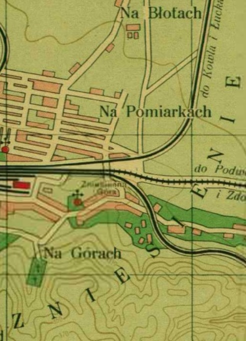
1932 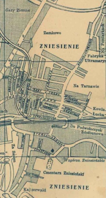
1939
By Areta Kovalska
Sources:
Львів і його села: як місто збільшувало свої межі
Історичні місцевості Львова
Wielki Lwów
Адміністративний поділ Львова
Міський медіаархів
Львів і його села. Як місто розширювало свої території
Ю. О. Бірюльов. Архітектура Львова: Час і стилі ХІІІ-ХХІ ст. “Центр Європи”, 2008
Енциклопедія Львова. “Літопис”
Polona.pl
http://dir.icm.edu.pl/pl/Slownik_geograficzny/Tom_VIII/14
I would love to have your email address so I can send you some interesting details about my surname Halko and the possibility of being connected to bringing Greek Orthodox to the Rus in 966 and being the foundation for the Szalawa Coat of Arms for Halka-Ledochowski.
Is there a genealogist/historian researcher I can make contact with and hire for further studies.
My email is: forgottengalicia@gmail.com