A benchmark is a geographic point whose elevation has been measured and recorded to a high level of accuracy. The height of a benchmark is calculated relative to the heights of nearby benchmarks in a network extending from a fundamental benchmark (a point which records a height to extreme accuracy). Benchmarks are used by such professionals as surveyors, engineers, and map makers.
In 1880-1888, the Department of Geodesy of the Lviv Polytechnic created the first leveling network in Lviv consisting of 18 benchmarks. The network was used for the construction of Lviv’s first sewer system.
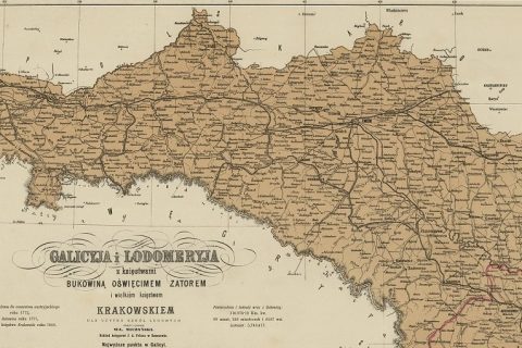
The state leveling network in Galicia was created by the Military Geographical Institute in Vienna between 1888 and 1892.
Lviv’s fundamental benchmark was installed on the wall of the main building of the Lviv Polytechnic in 1880 by famous astronomical surveyor, rector of the Lviv Polytechnic, Professor Dominik Zbrożek. The height was determined by barometric surveying from the level of the Adriatic Sea with the help of a highly skilled international commission.
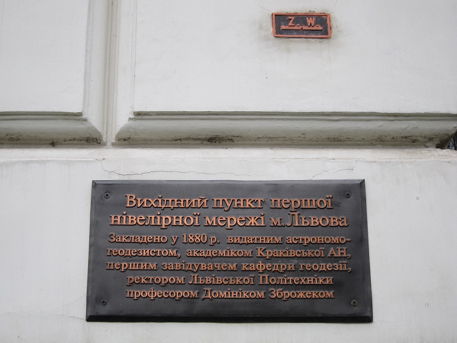
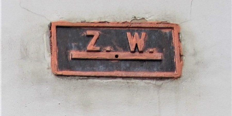
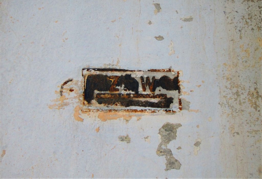
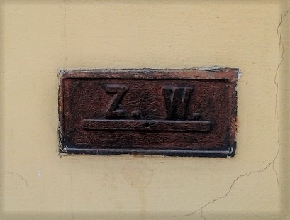
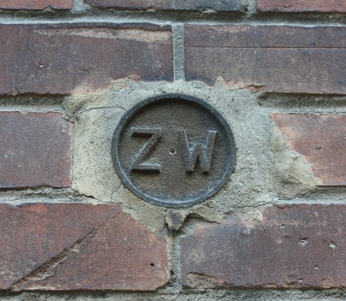
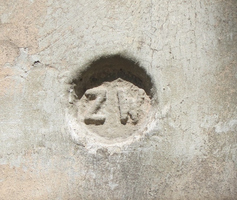
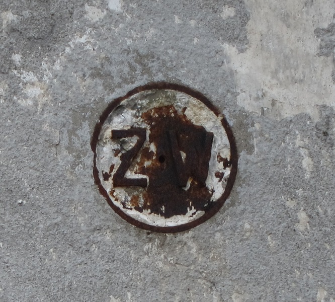
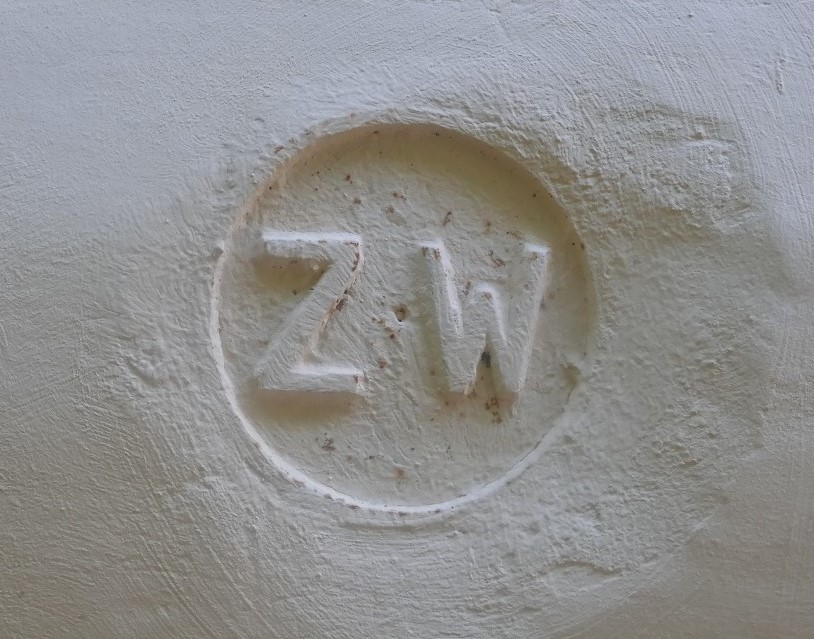
These first wall markers had the inscription “Z.W.” which stands for “znak wysokości,” Polish for “height marker.” They were often mounted on churches and other public buildings.
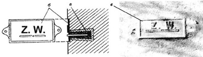
Wall marker
а – brass frustum in the wall;
б – iron plate labeled Z. W. (Znak wysokości);
в – modern look.
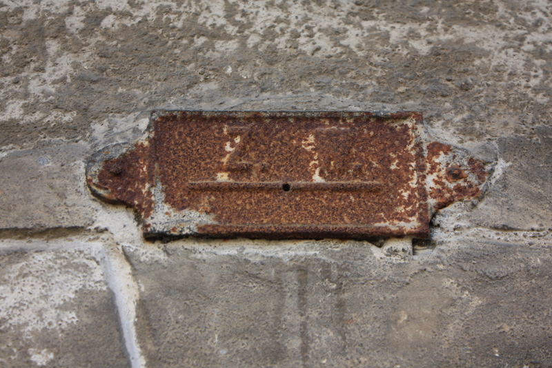
I’ve only been able to find a handful of the original 18 benchmarks in Lviv’s urban landscape. Others are either under plaster or have been removed. Here a few examples of some the first markers as well as the place where one used to be:
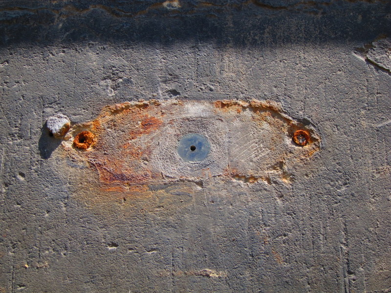
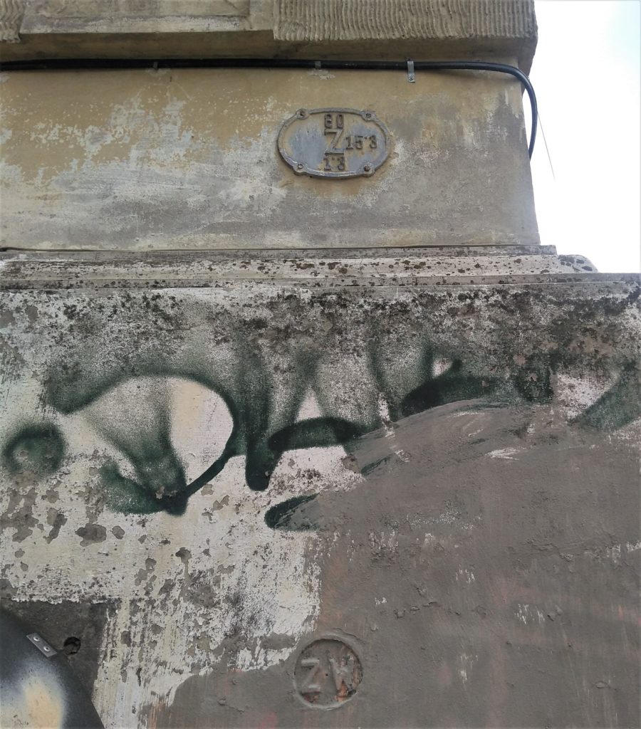
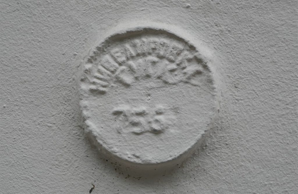
Another series of benchmarks are round metal plaques with the abbreviation “Z. W.” One is on the former Church of Our Lady of Perpetual Help (built 1893-1895), the second is on some type of old governmental building (it has a Lviv coat of arms), the third on the old Lychakiv railway station (built in 1906), and the fourth on the former Ukrainian Pedagogical Institute (built 1906-1908):
Here’s another one that’s been painted over. (The plaque on top is a stop valve marker.)
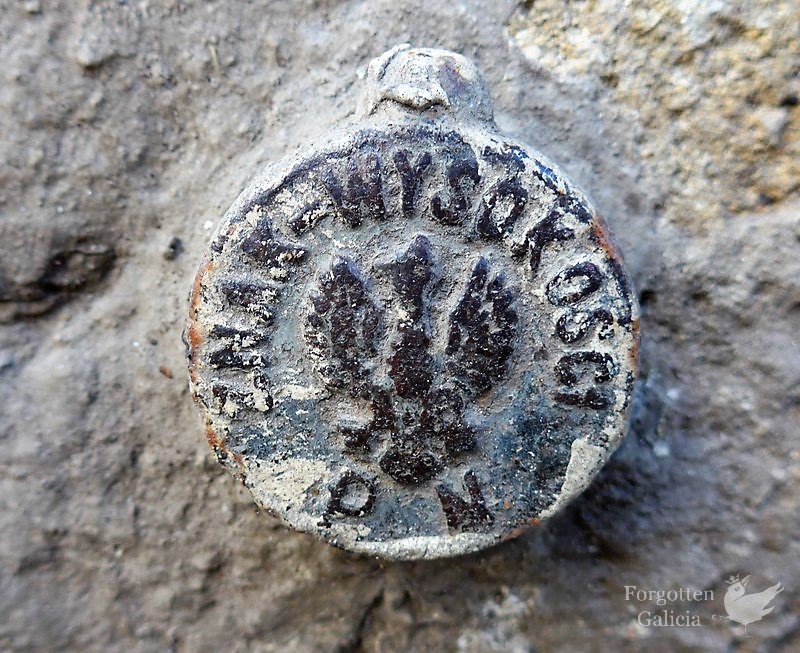
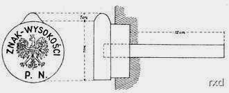
This next benchmark is mounted on the Lviv City Hall. The inscription reads “znak wysokości” (Polish for “height marker”) and has the letters “P. N,” which stands for “Precyzyjna Niwelacja” (Precise Leveling). In the middle is Poland’s coat of arms, which means it dates from the interwar period when Lviv was part of the Second Polish Republic.
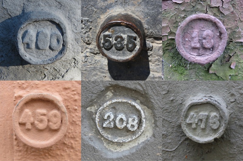
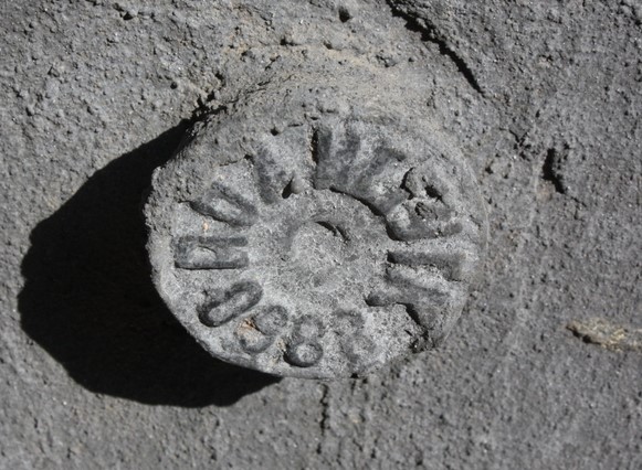
Yet another series of benchmarks includes ones numbers. I believe these are also from the pre-Soviet era. This type can still be found on a number of buildings around Lviv:
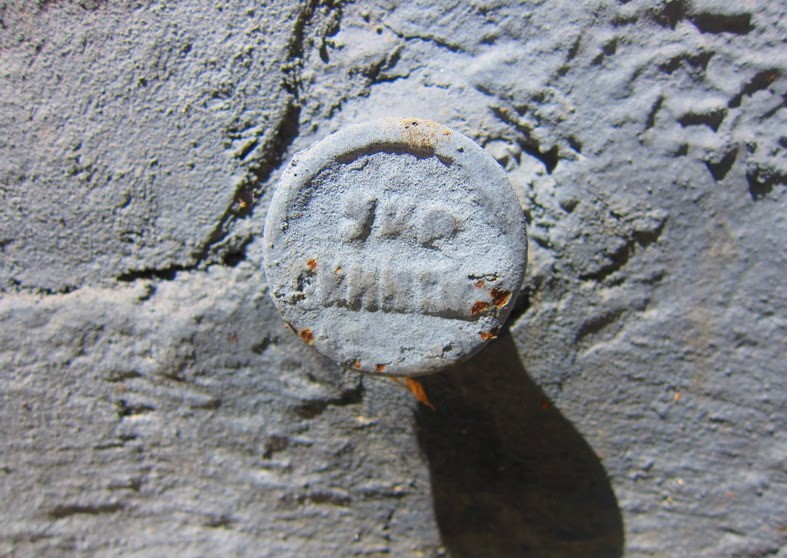
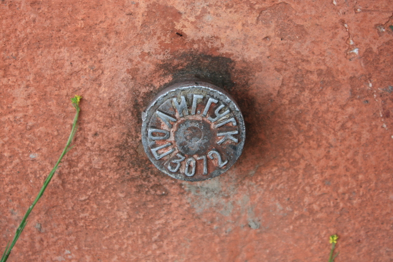
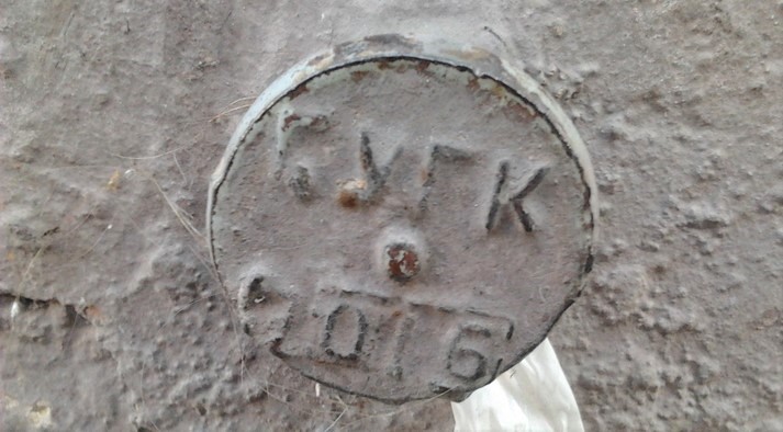
Then there are a few different kinds of benchmarks from the Soviet era. These generally have some sort of letters (abbreviations) along with numbers.
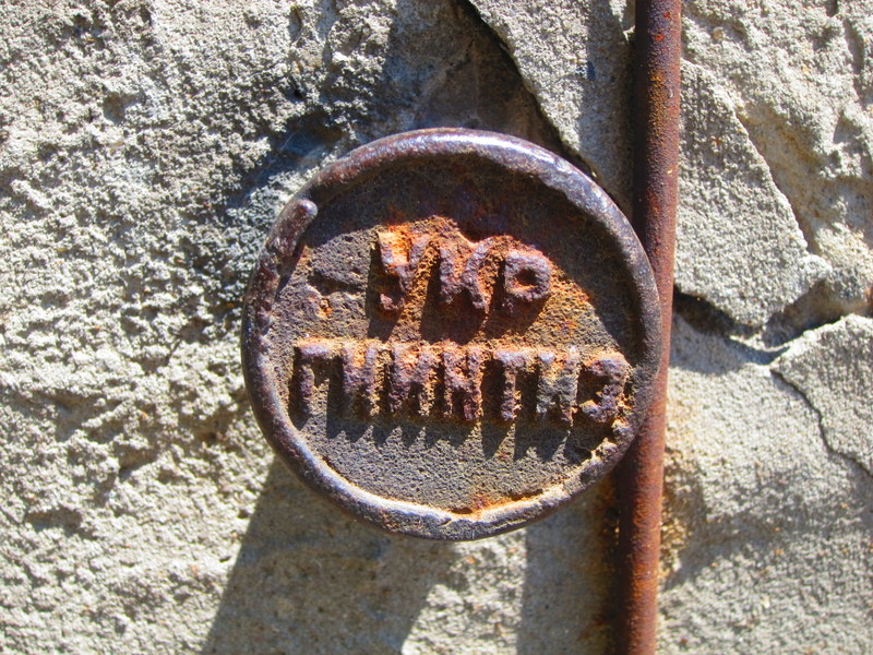
УКР ГИИНТИЗ (UKR GIINTIZ) = Russian abbreviation for Ukrainian Geological-Engineering and Technical Surveying. (For example, a GIINTIZ institute would teach such subjects as geology, geodesy, and geophysics.)
ПОЛИГ (POLIG) = short for “polygonometry” – method of establishing geodetic networks
ГУГК (GUGK) = the Head Office of Geodesy and Cartography
3072 = number of the marker in the registry with the geodesic description of its location
By Areta Kovalska